Tarralla Creek Trail works
- Project categoryFootpaths, Parks and reserves
- StatusCompleted
- Approx. start date01 March 2022
- Approx. end date30 June 2022
Council is committed to improving safety along the Tarralla Creek Trail where there is limited sight distance between shared path users travelling in opposite directions.
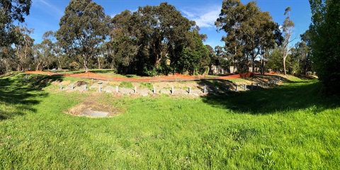
Tarralla Creek Trail – Site 3
To improve the sight distance at the bend at the rear of the Hunter Court properties to the Australian Standard, Council will realign the shared path closer to the open drainage channel to the east.
Works include:
- The reconstruction and realignment of the existing asphalt shared path in concrete. The path reconstruction will extend to the previously constructed works near Lucania Close to the south and near Teak Court to the north.
- The installation of retaining wall in Melbourne Water’s Tarralla Creek embankment and pedestrian fencing.
Plans
View the plans:
Tarralla Creek Site 3 - Civil Design Plan(PDF, 6MB)
Path closures and detours
To facilitate a safe working environment for the public and the contractors it is necessary to close the shared user path in stages during the works and detour pedestrians and cyclists via Gracedale Avenue. Detour signage will be in place.
Stage 1
Path closed between Kandra Street and Teak Avenue. Detour via Teak Avenue to Gracedale Avenue to Kandra Street.
Stage 2
Path closed between Lucania Close and Kandra Street. Detour via Kandra Street to Gracedale Avenue to Lucania Close.
Stage 3
Path closed between Lucania Close and Teak Avenue. Shared user path to be detoured via Teak Avenue to Gracedale Avenue to Lucania Close.
The pedestrian bridge across the creek at Kandra Street will be closed during stage 3. Path users wishing to cross the creek will be detoured via the pedestrian bridge located between Gracedale Park and Berry Road.
Background
In 2010, following community concern with the lack of visibility at several locations along the Tarralla Creek Trail, Council’s Engineering Officers undertook a detailed traffic investigation and report of the trail between Canterbury Road and Leigh Road in Croydon. The investigation determined that 8 key sites along the trail had sight distances significantly less than the required distance in accordance with the Austroads Guidelines.
Since the investigation, Council has been progressively working through the list of 8 sites, implementing a combination of path realignment, landfill and retaining wall construction, to increase the sight distance to the required distance.
At this stage, 7 of the 8 sites have been completed, with site 3 remaining.
Further information
For further information, please call Council on 1300 88 22 33.
Contact details
Location
1 Hunter Court, Ringwood East 3135 View map
-37.8250865,145.2646418
1 Hunter Court ,
Ringwood East 3135
1 Hunter Court ,
Ringwood East 3135
Tarralla Creek Trail works