Walks and trails maps
Maroondah has some beautiful and historically significant walks throughout the city.
Signed walking routes
There are a number of clearly signed walking circuits in Maroondah, which have varied lengths and link to local landmarks including schools, shops and other community facilities.
The walking routes use our existing footpath network, as well as other shared path trails.
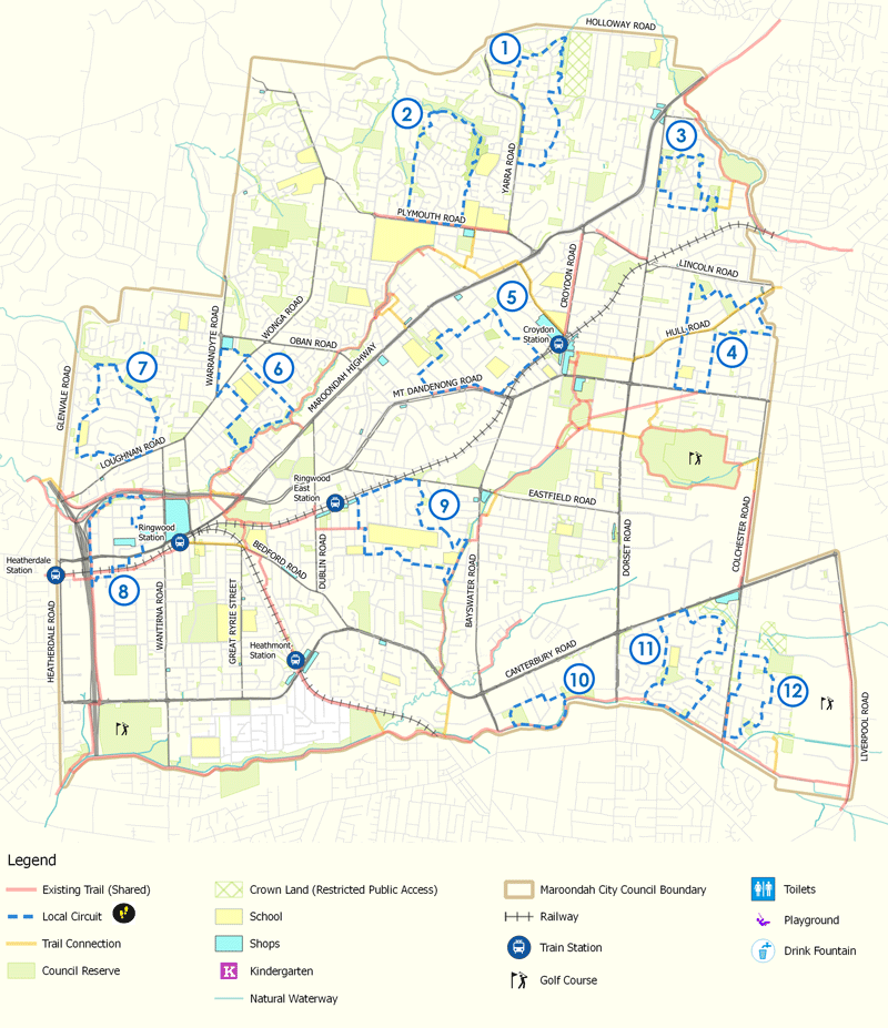
Download a copy of the map(PDF, 199KB)
- Yarra walking route
- Candlebark Walk
- The Range walking route
- Ruskin Park walking route
- Ainslie walking route
- Mullum walking route
- Ringwood Heights walking route
- Heatherdale walking route
- Eastwood walking route
- Glen Park walking route
- Canterbury Gardens walking route
- Bungalook walking route
Melbourne to Warburton Trail
The Melbourne to Warburton Trail is a 105-kilometre multi-use trail, stretching from the heart of Melbourne’s CBD, winding through the eastern suburbs and townships to Warburton, via the scenic Yarra Valley.
The trail is accessible to pedestrians, cyclists and, in some sections, horse riders, connecting people to some of Australia’s finest cultural experiences, hospitality venues and tourism destinations.
The Melbourne to Warburton Trail Map is an online interactive map that will guide trail users accessing the Melbourne to Warburton Trail.
Access the Melbourne to Warburton Trail Map
Accessible walks
Did you know that Maroondah has four accessible walks published by Victoria Walks? This is the most in any Victorian municipality!
See accessible walks
Historic walks
There are also 6 historic walks highlighting some of our significant buildings and rich heritage.
See historic walks
Maroondah's public art
Our outdoor spaces are home to numerous artworks, so use our Public Art listing and map to see what's near you.
Maroondah interactive map
Some of our significant walking and cycling trails are shown on our interactive map.
Select Walking & Cycling Trails on the map to see the trails, and zoom in to see more features, such as road and rail crossings.