Melbourne to Warburton Trail

The Melbourne to Warburton Trail is a 105-kilometre multi-use trail, stretching from the heart of Melbourne’s CBD, winding through the eastern suburbs and townships to Warburton, via the scenic Yarra Valley. The trail travels through Maroondah for 16km from Sherbrooke Park in Ringwood to Glen Dhu Road in Kilsyth, passing through HE Parker Reserve, Gracedale Park and Eastfield Park.
The trail is accessible to pedestrians, cyclists and, in some sections, horse riders, connecting people to some of Australia’s finest cultural experiences, hospitality venues and tourism destinations.
The Melbourne to Warburton Trail provides important local connections, linking people to schools, community services and regional destinations, and providing valuable opportunities for outdoor recreation, nature connection and active transport.
Route details
- Location: Ringwood to Kilsyth
- Distance: 16km
- Difficulty: Moderate
Map
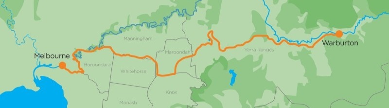
The Eastern Regional Trails Working Group is pleased to launch the Melbourne to Warburton Trail Map, an online interactive map that will guide trail users accessing the Melbourne to Warburton Trail.
Access the Melbourne to Warburton Trail Map
Eastern Regional Trails Working Group
The Eastern Regional Trails Working Group is a cooperative partnership between City of Boroondara, City of Monash, Knox City Council, Manningham Council, Maroondah City Council, Whitehorse City Council and Yarra Ranges Council.